Goal and Background
The main goal of this lab exercise was to develop an understanding of the use of unsupervised classification methods to extract information about surface features from remotely sensed images. The first part of this lab was focused on learning about inputs and configuration requirements necessary to run the unsupervised classifier. The second part of this lab was focused on taking the spectral classes created by the classifier and recoding them into useful thematic information about land-use/land-cover (LULC).
Methods
Part 1: Experimenting with unsupervised ISODATA classification algorithm
To start off this lab, we were given an image of Eau Claire and Chippewa counties from Landsat ETM+ captured in June of 2000. We used this image to run a Iterative self-organizing data analysis technique (ISODATA) by using the Unsupervised Classification tool under Raster>Unsupervised>Unsupervised Classification. With the Unsupervised Classification tool window open, the input image of Eau Claire and Chippewa counties was put in and the output image was saved to the correct folder. Next, the ISODATA radio button was checked under the "Method" section and the number of classes was changed to be 10. The default parameters for "Initializing Options" as well as "Color Scheme Options" was selected followed by the default value for the convergence threshold before changing the "Maximum Iterations" to 250. After all the correct inputs were finalized, the model was run and the resulting image was brought into the viewer. With the classified image open in the viewer, the attribute table was opened and the viewer was synced to Google Earth to help in identifying the features to be classified. By changing the color of each class to a brighter, more identifiable color and comparing what features are that color we created 5 distinct LULC classes. These classes were water (blue), forest (dark green), agriculture (pink), urban/built-up (red), and bare soil (sienna).
Part 2: Improving the accuracy of unsupervised classification
Part 2 of this lab was similar to part 1 as the same ISODATA unsupervised classification scheme was used but with slightly different input parameters compared to part 1. The only input parameters that were different in this iteration compared to the first was a Convergence Threshold of 0.92 as compared to the 0.95 used in part 1 and a maximum number of classes of 20 compared to the 10 classes created in part 1. Once these parameters were changed, the tool was run and the output image was brought into a viewer. Just as in part 1, the attribute table was opened and all 20 of the classes were labeled as belong to one of the five classes; water, forest, agriculture, urban/built-up, or bare soil. Once this was done, the Raster Attribute Editor and the Column Properties window was used to better order the data in the attribute table for easier analysis. Once this was done, the next step was to create a map using the 20 classifications but to do this those 20 classifications needed to be cut down to 5. To do this, the Recode tool was used under Raster<Thematic<Recode. Using the Recode tool and the Thematic Recode window, the 20 classes were condensed into 5 classes, one for each of the LULC classes. Again, column properties were edited to make analysis easier and finally the image was exported into Arcmap where a map was created to represent the various LULC classes for Eau Claire and Chippewa counties.
Results
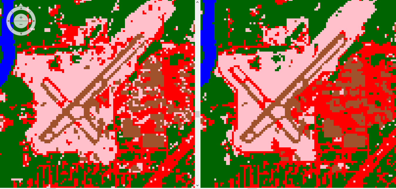
Figure 1. - Difference between 10 classes (left) and 20 classes (right) showing the higher accuracy present with a higher number of classes.

Figure 2. - Final attribute table of five classes once Recode tool had been used.

Figure 3. - Final map showing various LULC of Eau Claire and Chippewa counties.
Sources
Landsat satellite image is from Earth Resources Observation and
Science Center, United States Geological Survey.


No comments:
Post a Comment